


Voting District 0900031, Suffolk County, New York
About
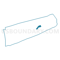
Outline

Summary
| Unique Area Identifier | 637292 |
| Name | Voting District 0900031 |
| County | Suffolk County |
| State | New York |
| Area (square miles) | 18.03 |
| Land Area (square miles) | 2.85 |
| Water Area (square miles) | 15.18 |
| % of Land Area | 15.80 |
| % of Water Area | 84.20 |
| Latitude of the Internal Point | 40.99695000 |
| Longtitude of the Internal Point | -72.34835890 |
Maps


Graphs
Select a template below for downloading or customizing gragh for Voting District 0900031, Suffolk County, New York


Neighbors
Neighoring Voting District (by Name) Neighboring Voting District on the Map
- Voting District 0300002, Suffolk County, NY
- Voting District 0300012, Suffolk County, NY
- Voting District 0700002, Suffolk County, NY
- Voting District 0700004, Suffolk County, NY
- Voting District 0900002, Suffolk County, NY
- Voting District 0900004 0900016, Suffolk County, NY
- Voting District 0900015, Suffolk County, NY
- Voting District 0900021, Suffolk County, NY
- Voting District 0900028, Suffolk County, NY
- Voting District 0900039, Suffolk County, NY
- Voting District 0900042, Suffolk County, NY
- Voting District 1000011, Suffolk County, NY
- Voting District 1000019, Suffolk County, NY
Top 10 Neighboring County Subdivision (by Population) Neighboring County Subdivision on the Map
- Southampton town, Suffolk County, NY (56,790)
- Southold town, Suffolk County, NY (21,968)
- East Hampton town, Suffolk County, NY (21,457)
- Shelter Island town, Suffolk County, NY (2,392)
Top 10 Neighboring Place (by Population) Neighboring Place on the Map
- North Sea CDP, NY (4,458)
- Noyack CDP, NY (3,568)
- Sag Harbor village, NY (2,169)
- North Haven village, NY (833)
Top 10 Neighboring Unified School District (by Population) Neighboring Unified School District on the Map
- Southampton Union Free School District, NY (10,093)
- Mattituck-Cutchogue Union Free School District, NY (9,193)
- East Hampton Union Free School District, NY (8,540)
- Sag Harbor Union Free School District, NY (6,741)
- Southold Union Free School District, NY (6,332)
- Shelter Island Union Free School District, NY (2,392)
Top 10 Neighboring State Legislative District Lower Chamber (by Population) Neighboring State Legislative District Lower Chamber on the Map
Top 10 Neighboring State Legislative District Upper Chamber (by Population) Neighboring State Legislative District Upper Chamber on the Map
Top 10 Neighboring 111th Congressional District (by Population) Neighboring 111th Congressional District on the Map
Top 10 Neighboring Census Tract (by Population) Neighboring Census Tract on the Map
- Census Tract 2009.02, Suffolk County, NY (6,410)
- Census Tract 1702.01, Suffolk County, NY (5,748)
- Census Tract 1700.01, Suffolk County, NY (5,613)
- Census Tract 1907.06, Suffolk County, NY (4,794)
- Census Tract 1907.07, Suffolk County, NY (4,669)
- Census Tract 1700.02, Suffolk County, NY (4,381)
- Census Tract 1803, Suffolk County, NY (2,392)
- Census Tract 1907.08, Suffolk County, NY (2,020)